Research
The Battlefield that will be used for this lesson is located in Perryville, Kentucky. The battle was fought in October of 1862 and was part of a campaign by the Confederates to invade the state of Kentucky which was a ‘neutral state[1]’. Kentucky supplied military units to both sides during the war and it was not uncommon to have brother fighting brother, this was common in all of the neutral states. Civil war battlefields usually have two names one the name given by the Confederacy and one by the Union. The Confederacy named battlefields after towns and the Union named them for geographic features, such as rivers. While a few of the battlefields still carry both names, generally one name is used. Perryville is the commonly used name, but it is also known as Chaplin Hills. There were lots of reasons to invade Kentucky, some being, recruiting men to join the confederacy, bringing the fight to the north (most battles to this time had been fought in the South), relieving the pressure on southern cities (so that they could produce much needed war supplies) and to make Kentucky a member of the Confederacy. It should not be forgotten that President Lincoln was born in Kentucky and that his wife, Mary Todd Lincoln, had brothers fighting for the Confederacy. Kentucky had military units which fought on both sides at the Battle of Perryville. The battle was not fought in the town of Perryville, but nearby. Perryville contains buildings which are still in use from the time of the battle, many of these building saw use after the battle as hospitals. There are many books written about this battle; electronic (online) resources will be used for a foundational understanding of the battle, such as the location, the officers, the men and the geography. Research is always critical as part of any mapping project and in this case the research is of both a current view of the area and also a historical review. As part of the author’s research he traveled to the site numerous times. The visits included taking numerous photographs of locations to use as part of the research project. This entire project was a demonstration project for work that would later be conducted at the Gettysburg Battlefield.
Online Resources
The Staff Ride Handbook for Battle of Perryville[2] http://usacac.army.mil/cac2/cgsc/carl/download/csipubs/cameron.pdf is a document used by US military officers to understand the Perryville conflict. This document gives a good understanding of the foundational events for this battle as well as an understanding of the military structure and the commanders. The staff ride has a good discussion of decisions that were made leading up to this engagement. This document provides a solid foundation to use both at the location as well as to gain an understanding of the events.
The Civil War Trust is an excellent site for obtaining battlefield maps and to learn about the battle. http://www.civilwar.org/battlefields/perryville.html
Part of the Perryville battlefield is located within a Kentucky State Park. At the battlefield site is a museum dedicated to the battle. The Friends of Perryville Battlefield operates the museum and maintains a website. http://www.perryvillebattlefield.org/
Wikipedia contains a comprehensive article about the battlefield and lots of maps that have been drawn for different times of the day. As with any information contained within an open resource like Wikipedia, you need to independently check to make sure the information is fully accurate. http://en.wikipedia.org/wiki/Battle_of_Perryville
There are also numerous books that have been written which are useful to someone researching this historical battle and battlefield. During each year a major reenactment of the battle is performed. The author attended the 150th anniversary of the battle reenactment in October of 2012.
Brief History
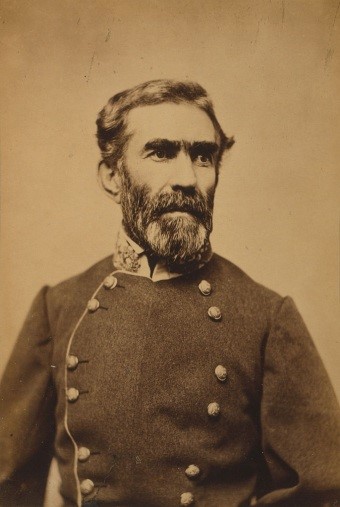 Figure 1: General Braxton Bragg, from Wikimedia
The battle was fought on October 8, 1862 and found the Confederate Army severally outnumbered by the Union Army, but not all components of the Union Army took part in the battle, which equalized the battle and also led to the reason the Confederate Army retreated during the evening of October 8. The Confederate Army was commanded by General Braxton Bragg and he had about 16,800 men.[3] His Army of the Mississippi had two wings commanded by Major General William J. Hardee and Major General Leonidas Polk. He had both cavalry and 56 cannons.
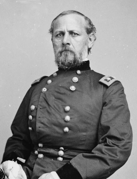 Figure 2: Major General Don Carlos Buell from Wikimedia
The Army of the Ohio was commanded by Union Major General Don Carlos Buell and had a strength of 55,261 men which were composed into three corps[4]. The corps were commanded by Major General Alexander M. McCook, Major General Thomas L. Crittenden and Major General Charles C. Gilbert. Major General George H. Thomas was second in command. The Union Army had cavalry as well and 147 cannons.
The Union Army was chasing the Confederate forces and thus, to protect his forces from being attacked from the rear, General Bragg decided to concentrate his army at Perryville. Perryville had a good supply of water which was a critical factor because of a drought in the region that year. The lack of water would be a critical factor in this battle as well as the control of the high ground.
The initial shots occurred early on October 8 but the actual battle did not start until afternoon. As will be discovered in this mapping lesson, geography will play a critical role in this battle. The fact that Perryville had four major roads and two secondary roads was another factor for selecting this location. The Chaplin River was a significant feature as well as Doctor’s Creek.[5] The Union Army was moving from the west toward the east in multiple columns. With an army the size of the Union force, the army was spread over multiple roads and had very long columns.
Basemap
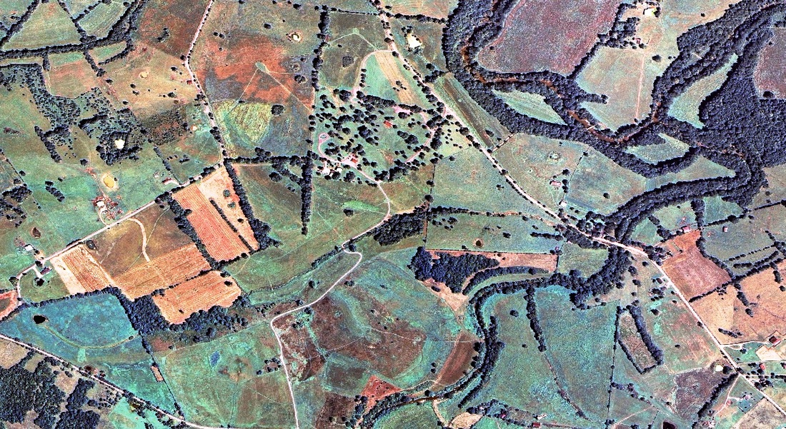
Figure 3: Portion of the Orthographic Projection for the Perryville Battlefield projected in Kentucky Unified State Plane
The basemap will be the surface in which the georeferencing will be produced. It is critical to establish a layer that has a projection or to project the base layer chosen. The layer which was selected for this lesson was 2 foot aerial resolution, flown in 2006, for the State of Kentucky. The orthographic images came from the Kentucky Division of Geographic Information (DGI). The needed images for this lesson have been downloaded and decompressed. It took multiple images to cover the area and they have been made into a mosaic using Esri ArcToolbox. The orthographic image is located for download at: http://legacy.jefferson.kctcs.edu/techcenter/gis%20data/country/usa/state/ky/raster/civil war/Perryville2.zip (this is not the original data site but a location made available for learners to simplify the process). The images are projected in Kentucky Unified State Plane.[6] The State Plane system works very well for data that does not cross state boundaries and is used in many surveying and engineering applications.[7] Kentucky has a unified state plane and also a northern and southern division of the state plane; most data today is in the unified state plane. The user could select a different aerial image such as those that can be selected from within Esri ArcMap.
Shapefiles
Once a projected basemap has been established for the reference layer the next task is to locate information about major features such as rivers, water features, modern roads, and other geographic items of interest. The U.S. Census Bureau’s TIGER[8] data is a good starting location. For this example, data from the Kentucky geospatial website was selected. These shapefiles need to be projected; so they will overlay with the base raster image. Water played an important role in the battle, therefore these features are important for the analysis. The Kentucky River shapefiles are located at: http://legacy.jefferson.kctcs.edu/techcenter/gis%20data/country/usa/state/ky/lines/kyrivers.zip. These files will be in a compressed format and must be decompressed before using.
[1] A neutral State is a state that did not leave the Union, but supplied troops to both sides.
[2] There are many different staff ride books (booklets) about different Civil War Battlefields. These, in general, were created to provide army officers the ability to observe historical battles from both a tactical standpoint as well as terrain. Many of these historical battlefields can be a good learning environment for officers.
[3] http://en.wikipedia.org/wiki/Battle_of_Perryville
[4] In the Union Army a corps is composed of usually 2 divisions, a division is composed of usually three or more brigades, a brigade is composed usually of four or more regiments, regiments are composed of usually ten companies and, in theory, a company should contain about 100 men and officers. Rarely did regiments have a full number of men ready for duty. Confederate armies had a similar alignment but did not use the corps, and each of the units had different numbers then the Union.
[5] Kolakowski, Christopher L., The Civil War at Perryville: Battling for the Bluegrass, The Historical Press, 2009
[6] State Plane is a geographic projection
[7] http://geology.isu.edu/wapi/geostac/Field_Exercise/topomaps/state_plane.htm
[8] Topologically Integrated Geographic Encoding and Referencing
