Historical Maps
Non-Georeferenced Maps
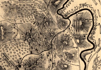 Figure 1: Portion of Historical Map of Perryville Battlefield from David Rumsey Collection
The next step is to locate and download both historical battlefields maps (constructed during or soon after the battle) and more modern maps. When using a modern map, it is important to document the accuracy, since some maps are drawn to show only details and scale is not important. There are numerous locations to obtain battlefield maps. For some of the most popular battles, such as Gettysburg[1], the number of historical and modern maps is much greater than for smaller engagements. Many of the eastern battlefields have a greater popularity and had a larger number of casualties[2]. A good starting place for any historical mapping project, especially the Civil War, is the Library of Congress at: http://memory.loc.gov/ammem/collections/civil_war_maps/, The David Rumsey Map Collection is another source, it is open to the public but owned by a private company/individual http://www.davidrumsey.com/. A third source to consult is the Old Maps Online Library at http://www.oldmapsonline.org/. Be aware of any copyright requirements or other restrictions, source information must be documented. The author also maintains a library of Civil War maps for which research has either been conducted or is planned. The author has posted maps that are in the public domain. http://legacy.jefferson.kctcs.edu/geotechcenter/MapsSite/HistoricalMaps.html.
Modern maps of the Perryville battlefield can be obtained from the Civil War Trust at http://www.civilwar.org/battlefields/perryville/maps/perryvillemap.html and from the Wikipedia article http://en.wikipedia.org/wiki/Battle_of_Perryville. Hal Jespersen is the cartographer of many of the Wikipedia maps, they are available at http://www.cwmaps.com/freemaps.html. The overall appearance of Mr. Jespersen maps are excellent. Many of the modern and historical maps have a time stamp for troop positions; this is important for the battlefield analysis. The topography is an important factor in understanding the troop positions and how they moved. Some maps have multiple locations of the same unit which are color coded, this can make the maps confusing when the colors are similar. Generally units are represented at the regimental[3] level, they will carry a state designation and a number, and referred to as volunteer troops, though many were drafted into the army. There are also what are known as regular troops, which do not have a state designation, how these troops are represented varies by the map maker. Historical maps are generally created in a single color, while many of the modern day maps are created electronically in multiple colors. On color maps the Union troops are shown in a dark blue and the Confederate troops in a red. Both historical and modern battlefield maps can have scale issues as well as survey issues. Therefore, the georeferencing process will cause stretching and compression of the map causing some items to look distorted.
Modern maps of the Perryville battlefield can be obtained from the Civil War Trust at http://www.civilwar.org/battlefields/perryville/maps/perryvillemap.html and from the Wikipedia article http://en.wikipedia.org/wiki/Battle_of_Perryville. Hal Jespersen is the cartographer of many of the Wikipedia maps, they are available at http://www.cwmaps.com/freemaps.html. The overall appearance of Mr. Jespersen maps are excellent. Many of the modern and historical maps have a time stamp for troop positions; this is important for the battlefield analysis. The topography is an important factor in understanding the troop positions and how they moved. Some maps have multiple locations of the same unit which are color coded, this can make the maps confusing when the colors are similar. Generally units are represented at the regimental[3] level, they will carry a state designation and a number, and referred to as volunteer troops, though many were drafted into the army. There are also what are known as regular troops, which do not have a state designation, how these troops are represented varies by the map maker. Historical maps are generally created in a single color, while many of the modern day maps are created electronically in multiple colors. On color maps the Union troops are shown in a dark blue and the Confederate troops in a red. Both historical and modern battlefield maps can have scale issues as well as survey issues. Therefore, the georeferencing process will cause stretching and compression of the map causing some items to look distorted.
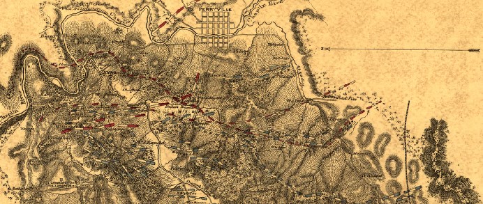 Figure 2: Portion of Historical Map of Perryville Battlefield
Georeferencing is the process of aligning a no referenced layer to a referenced map. In this example the orthographic basemap will be aligned to a battlefield map by comparing selected locators. The locators are stored in a text file. The orthographic image has a projection in Unified Kentucky State Plane, 1600. In georeferencing two correspondent points are referenced to the same location. The first point chosen is always the non-georeferenced map and the second point is on the referenced map.
There are complete lessons on georeferencing and digitization.
There are complete lessons on georeferencing and digitization.
Operational Procedure
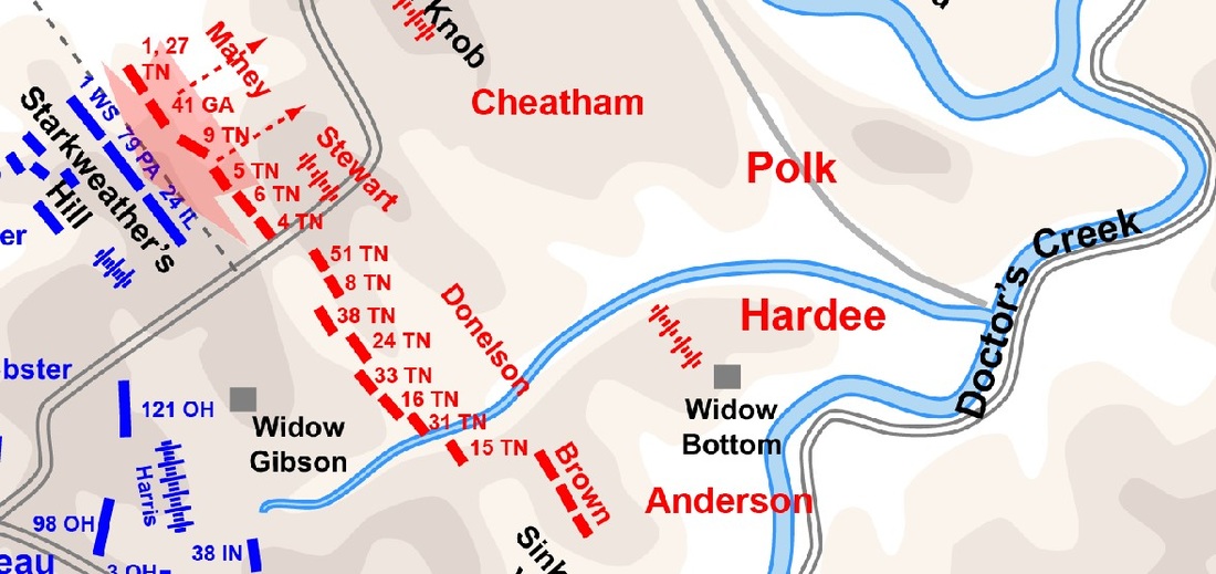 Figure 3: Portion of Perryville Battlefield from WikiMedia
This discussion will explain the order of operations, but will not go into depth on the methodology. Review the georeferencing technical skills lesson for more details.
- Load the projected layer and the non-georeferenced map.
- Manually explore the non-referenced and projected layer before beginning the process, it is important to have at least four points for referencing selected before attempting to complete this process. Depending on the map, there may need to be many more points selected beyond the initial ones, make sure the first points are easy to locate on the two maps and are as far apart as can reasonably be located.
- Make sure the non-referenced layer is above the projected layer in the Table of Contents.
- Turn on the georeferencing toolbar.
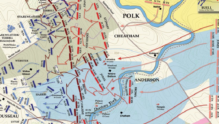
Figure 4: Civil War Trust Portion Perryville Battlefield
5. Make sure the layer to be referenced is in the Layer Window of the georeferencing toolbar.
6. Click on the red and green plus sign button on the georeferencing toolbar, this symbol is the tool used to select the points.
7. Click on a point on the non-referenced map; make sure the point selected is also on the projected map. The initial point selected might be a place where a stream joins another stream, or a house, a road intersection, etc.
8. Next go to the referenced layer and click on the corresponding point; the non-referenced layer may need to be turned off, since it is opaque.
9. Repeat steps 7 and 8 for the next point.
10. Once two points have been referenced, the two maps should overlay, but the accuracy will be very poor until several additional points have been selected. Making the non-projected layer semi-transparent will speed the process, since turning on and off the layer will not be required. Note: set the transparency so that details of both layers can still be determined.

11. Click on the button next to the red and green plus sign. This will open the Link Table, which shows the corresponding positions between the two layers. The x, y source are positions on the non-projected map and the x, y represents the latitude and longitude measured in decimal degrees as seen in Figure 13. Saving this file will create a method for projecting the map properly when loaded again, this file is saved as a text file, and the name of this file should be the same as the map file being georeferenced.
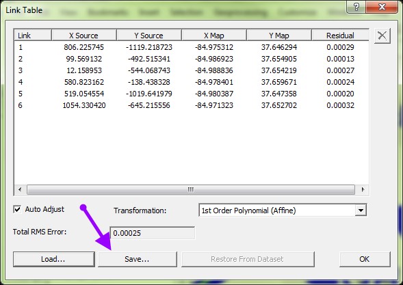
Figure 5: Link Table
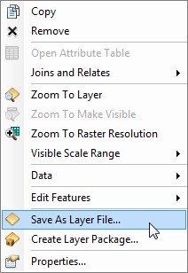
Figure 6: Layer File Window
Figure 6: Layer File Window
12. In general, a linear (1st order polygon), is the type of transformation that is produced, but other types of transformations can be selected by using the pull down.
13. If during the process a point is added that does not seem to help the alignment it can be deleted from the link data file. Never delete so many points at one time that there is not at least two points remaining in the file, if this is done it would require starting from scratch.
14. Once the link data file has been saved, save the file as a new layer file so that the link file does not need to be manually loaded each time the map is used. The link data file is saved as a text file. Right click on the file that was referenced and then click on Save as Layer File. A layer file does not contain the original image file or link data, it just points to the proper storage location. The files cannot be moved since this would break the links for the layer file to function properly, see Figure 6.
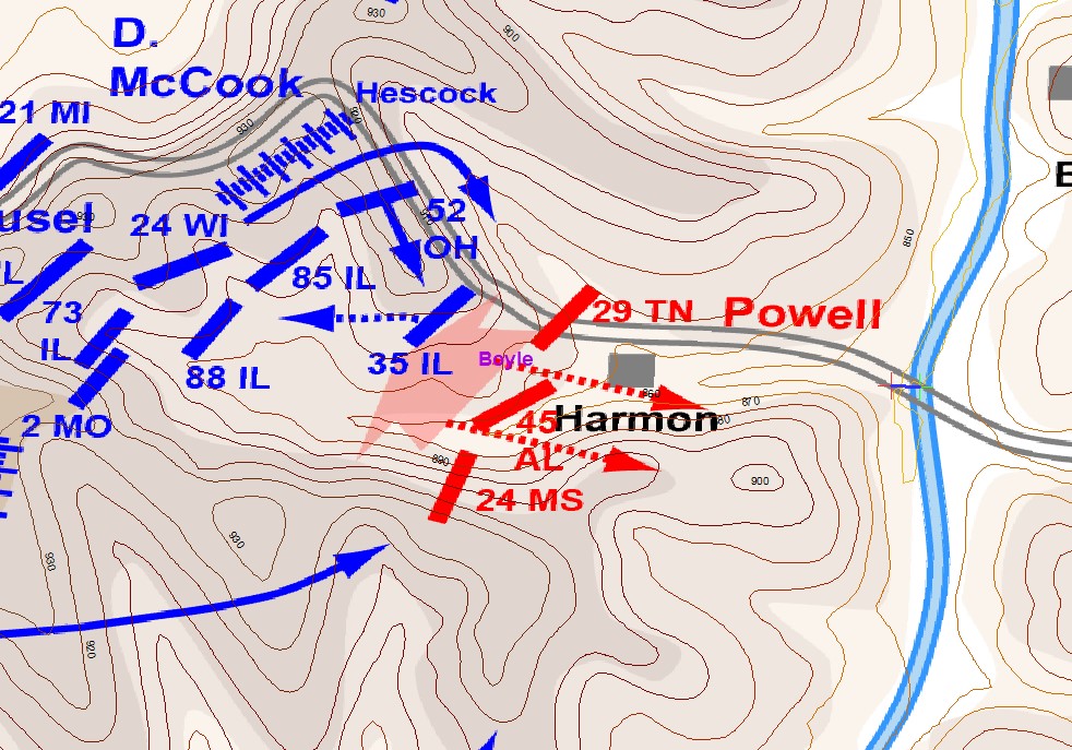
Figure 7: Results of Georeferencing of Perryville Battlefield at 4 PM, note: the contour lines have been overlaid on a troop position map that was georeferenced. Troop map from Wikimedia
[1] A battle that occurred in central Pennsylvania in July of 1863.
[2] A casualty is the number of people killed, wounded and missing in action. These numbers are generally more accurate for the Union Army than the Confederate Army. During the Civil War soldiers did not have identifiable items as standard issue.
[3] A regiment is the general fighting unit, in theory, composed of approximate 1,000 men for the union army and a larger number for the confederate. A typical regiment is composed of ten companies. Normally two or three regiments make up a brigade.
