 Figure 1: Landsat 8, from NASA
Platforms
There are three major types of platforms in which the detectors are used for aerial imagery, Devices can also be terrestrial based. A terrestrial based detector might be a device mounted to a vehicle, such as a van used to measure the height of overpasses on an Interstate highway, using a LiDAR detector[1]. The aerial detectors are used classified in one of three groups, satellites, manned aircraft and unmanned aerial vehicles. Each of these devices have specific areas in which they have the greatest effective usage.
Satellite
A satellite in orbit around the earth, in general, has the lowest resolution, but does provide a wide field of view and is periodic, which is great for the measurement of changes. Some satellites are placed in a geosynchronous orbit[2], but to achieve this stationary position requires that the satellite be much farther from the surface of the earth. Thus the area viewed while constant is much larger and thus less localized details. A weather satellite is an example of a non-periodic satellite in a geosynchronous orbit. Some of the down sides of a satellite are the facts that these orbiting platforms are outside of the atmosphere of the earth, which limits the effective transmission of certain wavelengths through the atmosphere, lack of data on days in which the cloud cover obscures the surface of the earth (unless the satellite is used for weather). Another issue is the size of each individual pixel which are large and small individual structures cannot be identified. In general satellites are passive detectors.
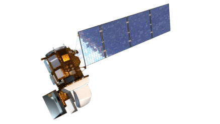
One of the most used periodic satellites used for remote sensing is Landsat. Landsat 8 (launched in 2013) orbits the earth in a polar orbit and images every part of the earth in multiple bands every 16 days.[3] The pixel size varies with different instruments. The satellite has 4 visible bands with a resolution of 30 meters, four near IR bands at 30 meters, panchromatic band with a resolution of 15 meters and two thermal IR bands with a 100 meter resolution.[4] Also available is data from previous Landsat satellites. Note Landsat 7 is still active.
Manned Aircraft
In general, a manned aircraft flies at a few thousand feet above the ground to photograph a much smaller area than would be accomplished with a satellite, the detectors also have considerable less atmosphere for the signals to pass through. In addition, an aircraft can be scheduled at the specific time needed instead of when the path of the satellite brings the instruments over the target. The resolution of the detected information is a much smaller area down to resolutions of less than 2 inches per pixel. This finer resolution dramatically increases the amount of data received, which can create storage issues. Oblique imagery[5] can also be taken with aircraft through the use of multiple cameras taking multiple simultaneous images and building a three dimensional model.
Unmanned Aerial Vehicles
Unmanned Aerial Vehicle (UAV) or an Unmanned Aerial System (UAS), which are referred to as drones, can take multiple configurations. The UAV is the aircraft, while the UAS is the complete system used. The size of these devices can vary from a few grams to those which are extremely large and used by the military. For this discussion only those used for non-military individualized geospatial purposes will be discussed and many of these weigh less than 55 pounds which mean they are generally referred to as small UAS (sUAS). These vehicles usually fall in to two classifications, those that are fixed wing and those with multiple rotators. The multiple rotator aircraft in general are very good stable platforms, that can hover and can carry high resolution cameras, used for flying relatively small areas. Many of the multiple rotator devices are used as a stationary platform and the camera can be controlled. Some uses include fire and police events, movie making, search operations, and 360 flights around an object. The fixed wing vehicles are meant to fly a pathway and do not hover. The speed of the devices varies with manufacturer but can exceed 50 miles per hour. Since these devices are relatively close to the ground, usually less than 400 feet, the size of an individual pixel can be less than a centimeter on a side. A large amount of data can be collected, each point on the surface of the earth in the study area can be in multiple images. Thus a three dimensional point cloud can be constructed and thus software analysis can be used to do volumetric measurements. Since these objects are in high speed motion care must be taken in determining the shutter speed[6] of the cameras as well as f-stop[7], focal length[8] of the lens and ASA/ISO[9].
[1] Lidar: Light Detection and Ranging http://oceanservice.noaa.gov/facts/lidar.html
[2] A geosynchronous orbit is achieved when the satellite orbits the earth at the exact same angular velocity as the earth turns, thus the satellite makes one revolution around the earth in a 24 hour period. This is achieved by placing the satellite at specific distance from the surface of the earth.
[3] http://landsat.usgs.gov/landsat8.php
[4] http://landsat.usgs.gov/band_designations_landsat_satellites.php
[5] Oblique imagery can be used to make three dimensional measurements of buildings, many cities use this type of images to determine changes in the community.
[6] Shutter speed is how long the detector can view the target usually in hundreds or thousands of a second.
[7] F-stop refers to the aperture of the lens, the smaller the number the larger opening of the lens. The larger the open the less depth of field, which is how accurate the focus of the camera.
[8] The small the focal length the larger the area that is visible, but also the greater the distortion at the edges of the image. A typical focal length would general be between 30 and 70 mm.
[9] ASA/ISO refers to the speed of the chip, the smaller the number the less sensitive, but the less graininess in the image, the higher the number the greater chip speed, but more distortion. The graininess is electronic ‘noise’.
There are three major types of platforms in which the detectors are used for aerial imagery, Devices can also be terrestrial based. A terrestrial based detector might be a device mounted to a vehicle, such as a van used to measure the height of overpasses on an Interstate highway, using a LiDAR detector[1]. The aerial detectors are used classified in one of three groups, satellites, manned aircraft and unmanned aerial vehicles. Each of these devices have specific areas in which they have the greatest effective usage.
Satellite
A satellite in orbit around the earth, in general, has the lowest resolution, but does provide a wide field of view and is periodic, which is great for the measurement of changes. Some satellites are placed in a geosynchronous orbit[2], but to achieve this stationary position requires that the satellite be much farther from the surface of the earth. Thus the area viewed while constant is much larger and thus less localized details. A weather satellite is an example of a non-periodic satellite in a geosynchronous orbit. Some of the down sides of a satellite are the facts that these orbiting platforms are outside of the atmosphere of the earth, which limits the effective transmission of certain wavelengths through the atmosphere, lack of data on days in which the cloud cover obscures the surface of the earth (unless the satellite is used for weather). Another issue is the size of each individual pixel which are large and small individual structures cannot be identified. In general satellites are passive detectors.
One of the most used periodic satellites used for remote sensing is Landsat. Landsat 8 (launched in 2013) orbits the earth in a polar orbit and images every part of the earth in multiple bands every 16 days.[3] The pixel size varies with different instruments. The satellite has 4 visible bands with a resolution of 30 meters, four near IR bands at 30 meters, panchromatic band with a resolution of 15 meters and two thermal IR bands with a 100 meter resolution.[4] Also available is data from previous Landsat satellites. Note Landsat 7 is still active.
Manned Aircraft
In general, a manned aircraft flies at a few thousand feet above the ground to photograph a much smaller area than would be accomplished with a satellite, the detectors also have considerable less atmosphere for the signals to pass through. In addition, an aircraft can be scheduled at the specific time needed instead of when the path of the satellite brings the instruments over the target. The resolution of the detected information is a much smaller area down to resolutions of less than 2 inches per pixel. This finer resolution dramatically increases the amount of data received, which can create storage issues. Oblique imagery[5] can also be taken with aircraft through the use of multiple cameras taking multiple simultaneous images and building a three dimensional model.
Unmanned Aerial Vehicles
Unmanned Aerial Vehicle (UAV) or an Unmanned Aerial System (UAS), which are referred to as drones, can take multiple configurations. The UAV is the aircraft, while the UAS is the complete system used. The size of these devices can vary from a few grams to those which are extremely large and used by the military. For this discussion only those used for non-military individualized geospatial purposes will be discussed and many of these weigh less than 55 pounds which mean they are generally referred to as small UAS (sUAS). These vehicles usually fall in to two classifications, those that are fixed wing and those with multiple rotators. The multiple rotator aircraft in general are very good stable platforms, that can hover and can carry high resolution cameras, used for flying relatively small areas. Many of the multiple rotator devices are used as a stationary platform and the camera can be controlled. Some uses include fire and police events, movie making, search operations, and 360 flights around an object. The fixed wing vehicles are meant to fly a pathway and do not hover. The speed of the devices varies with manufacturer but can exceed 50 miles per hour. Since these devices are relatively close to the ground, usually less than 400 feet, the size of an individual pixel can be less than a centimeter on a side. A large amount of data can be collected, each point on the surface of the earth in the study area can be in multiple images. Thus a three dimensional point cloud can be constructed and thus software analysis can be used to do volumetric measurements. Since these objects are in high speed motion care must be taken in determining the shutter speed[6] of the cameras as well as f-stop[7], focal length[8] of the lens and ASA/ISO[9].
[1] Lidar: Light Detection and Ranging http://oceanservice.noaa.gov/facts/lidar.html
[2] A geosynchronous orbit is achieved when the satellite orbits the earth at the exact same angular velocity as the earth turns, thus the satellite makes one revolution around the earth in a 24 hour period. This is achieved by placing the satellite at specific distance from the surface of the earth.
[3] http://landsat.usgs.gov/landsat8.php
[4] http://landsat.usgs.gov/band_designations_landsat_satellites.php
[5] Oblique imagery can be used to make three dimensional measurements of buildings, many cities use this type of images to determine changes in the community.
[6] Shutter speed is how long the detector can view the target usually in hundreds or thousands of a second.
[7] F-stop refers to the aperture of the lens, the smaller the number the larger opening of the lens. The larger the open the less depth of field, which is how accurate the focus of the camera.
[8] The small the focal length the larger the area that is visible, but also the greater the distortion at the edges of the image. A typical focal length would general be between 30 and 70 mm.
[9] ASA/ISO refers to the speed of the chip, the smaller the number the less sensitive, but the less graininess in the image, the higher the number the greater chip speed, but more distortion. The graininess is electronic ‘noise’.
