Final Steps
National Registry of Historical Places
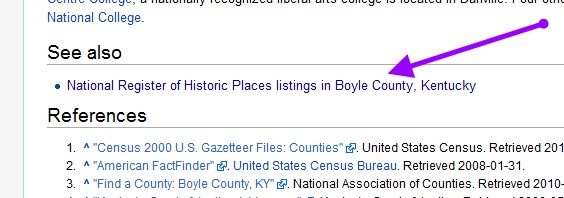 Figure 1: Boyle County Wikipedia Page
Using Wikipedia search for a specific county, in this example, Boyle County Ky. On the web page there is a reference to Historical Places (generally near the bottom), Click on the link to the National Register for the targeted county.
Once the Historical Place page opens, select Show (for a full menu), see Figure 2. Then select Export coordinates as a KML (see Figure 3), this will be downloaded to your download folder. These coordinates can be added to the map.
Once the Historical Place page opens, select Show (for a full menu), see Figure 2. Then select Export coordinates as a KML (see Figure 3), this will be downloaded to your download folder. These coordinates can be added to the map.
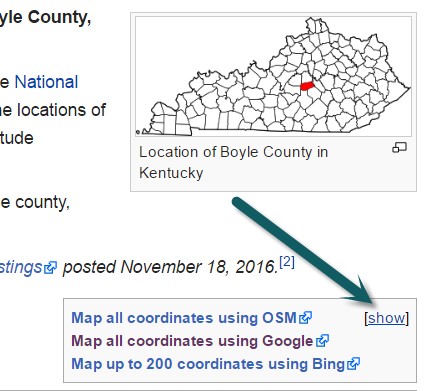
Figure 2: Wikipedia Historical Places for Boyle County
|
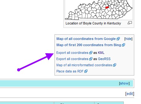
Figure 3: Exporting the Data as a KML
|
Final Product
Once all the information has been compiled, then it is important to display the information in a usable format for others to view. This might be in an electronic movie of troop positions as time changes during the day (not discussed in this course), a poster, and/or website showing the information. The information in this lesson was used by the author to create a two panel poster as well as a web map. In addition to making the information available to the general population the data can be used to perform analyses of the battlefield and to determine how modern information might have changed what occurred 150 years ago.
